

Road-Trip Stop No. 2:
From Sunday, July 21 through Friday, July 26, Sweetums and I drove 2,150 miles from Huntsville, Alabama, to Fort Worth, Texas, and back again. Some of you followed along on social media but I promised more detailed posts on all our stops. It will take a few weeks to get to them all. I am planning to post in order of the trip. The map is below. Most sites will be included in my upcoming Guide to Southern Oddities. Meanwhile, check out my personal Facebook page or Kelly Kazek’s Weird South or Instagram.
Abandoned Mississippi River Basin Model
Buddy Butts Park, 6180 McRaven Road, Jackson, Miss.
This was one of the most fascinating finds on our trip. We had no idea what to expect after reading about this long-abandoned scale model of the Mississippi River designed by the Corps on Engineers and built by prisoners of war beginning in 1943 to mitigate flooding – and even predict and prevent floods and droughts.

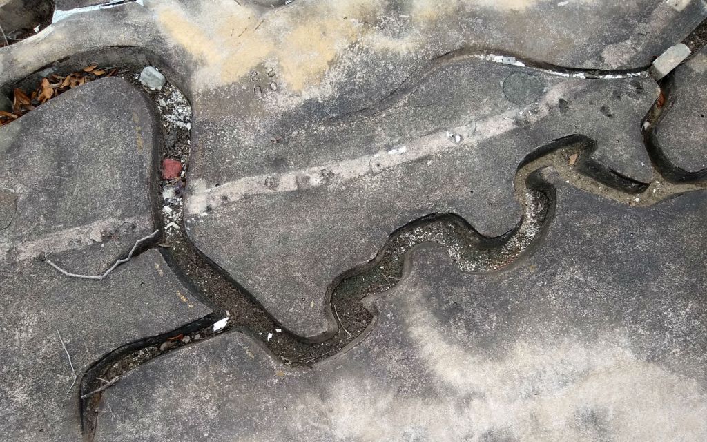
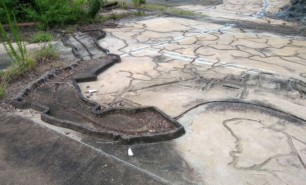
We finally found it and were surprised to discover it continued to meander far into the woods.
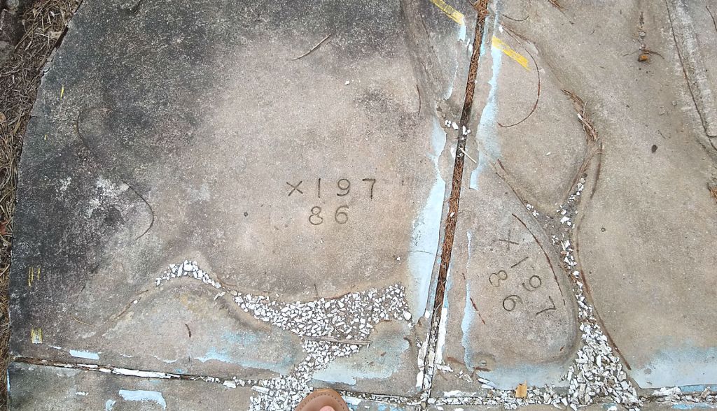
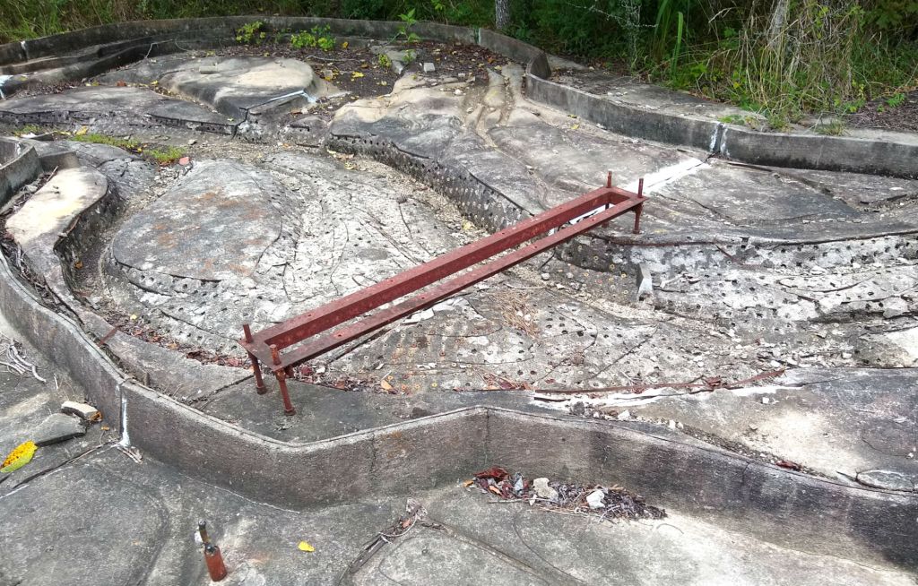
Made of concrete, the model covers a total of 200 acres, which represent the entire river basin with every curve and bump and stream. It has been unused for more than 40 years and abandoned for 20 years, so it is overgrown and not in great shape. At first, we thought we were seeing only a concrete parking lot. Dozens of pieces of mesh wire folded into accordions lay stacked atop the concrete in various places, obviously pulled from the model at some point. I have since learned they represented dense foliage along the model.
The Corps took from 1943 to 1966 to complete the model but experimentation began in 1949 and continued until 1973.

According to MadeinMississippi.com, it was the idea of engineer Eugene Reybold:
“As work began along the Mississippi River basin, it became clear to Major Eugene Reybold, a district engineer in Memphis, Tennessee, that there was really no way to keep up with the effects of all the changes being made or to test proposals so he came up with the idea of a large-scale hydraulic model that would enable engineers to observe the interactive effects of weather and proposed control measures over time and ‘develop plans for the coordination of flood-control problems throughout the Mississippi River Basin.”
In her article “The Scale of Nature: Modeling the Mississippi River,” Kristi Dykema Cheramie described the process:
“The prisoners cleared the site of a million cubic yards of dirt and rough-graded the land to match the contours of the Mississippi River Basin. To ensure that topographic shifts would be apparent, the model was built using an exaggerated vertical scale of 1:100 and a much larger horizontal scale of 1:2000. While the existing topography offered a close approximation of the actual Mississippi Basin, some areas required significant earthmoving; the Appalachian Mountains were raised 20 feet above the Gulf of Mexico, the Rockies 50 feet. An existing stream running east-to-west provided the model’s water supply. The streambed was molded to take on the shape and form of the upper reaches of the Mississippi, and a complex system of pipes and pumps distributed water throughout the model; it was regulated by a large sump and control house sited near what would become Chicago, Illinois. To simulate flood events, Reybold needed to introduce large volumes of water over short periods of time, so he designed a collection basin and 500,000-gallon storage tower system at the model’s edge. Small outflow pipes at anticipated data collection points channeled excess water to 16 miles of storm drains.”
Sweetums and I thought this was such a unique historic site and hope it will be preserved. It was designated a Mississippi Landmark but discussions of making it into a tourist attraction have not come to fruition.
To get there, go to Buddy Butts Park at the address above. Pass a small driving range and some fields. A couple of buildings from the experiment station remain, as does the water tower used for experiments in the model. At first, it looks as if the model is fenced off but keep going and you’ll see the way into the model. It is well worth the trip.

Read about Stop No. 1 here: The grave of the gypsy queen


I had never heard about this. Too cool!! I will put it on my list of places to visit.
LikeLike
You really should!
LikeLike
I’m sure you’ve seen the model on Mud Island…. sweet. Who owns this property? I, meaning you, could take this over. Add a restaurant or two and make a billion dollars….Hey it might even make a great putt-putt golf course. I’m in if I get to …..not sure what I get to do. We most likely will have a few good campfires with the brush and we may even see the Mississippi Sasquatch. I will provide marshmallows and graham crackers. Just let me know when you have some spare time. I will have to read the article again. Maybe I can be a Park Ranger? Is that the only problem. No Rangers? Can I get cable TV as I do have to keep up with my Braves and Tide? P
LikeLike
Are you kidding me……I know that you find numerous jewels. OK….. I can’t believe that this place isn’t gobbled up. I’ll bring my own shears and gloves. I’ll do my own research so don’t look for much of a cut……..finder’s fee is usually……..2%……3%…..1.5%. Wait a minute this is not private property?
LikeLiked by 1 person
It is the most amazing place!
LikeLike
IT’s on public property … and so fascinating!
LikeLike
back then how did they get the true conture of the bottom
LikeLike
Great question and I have no idea! Lol.
LikeLike